Describe what you Tennes-see


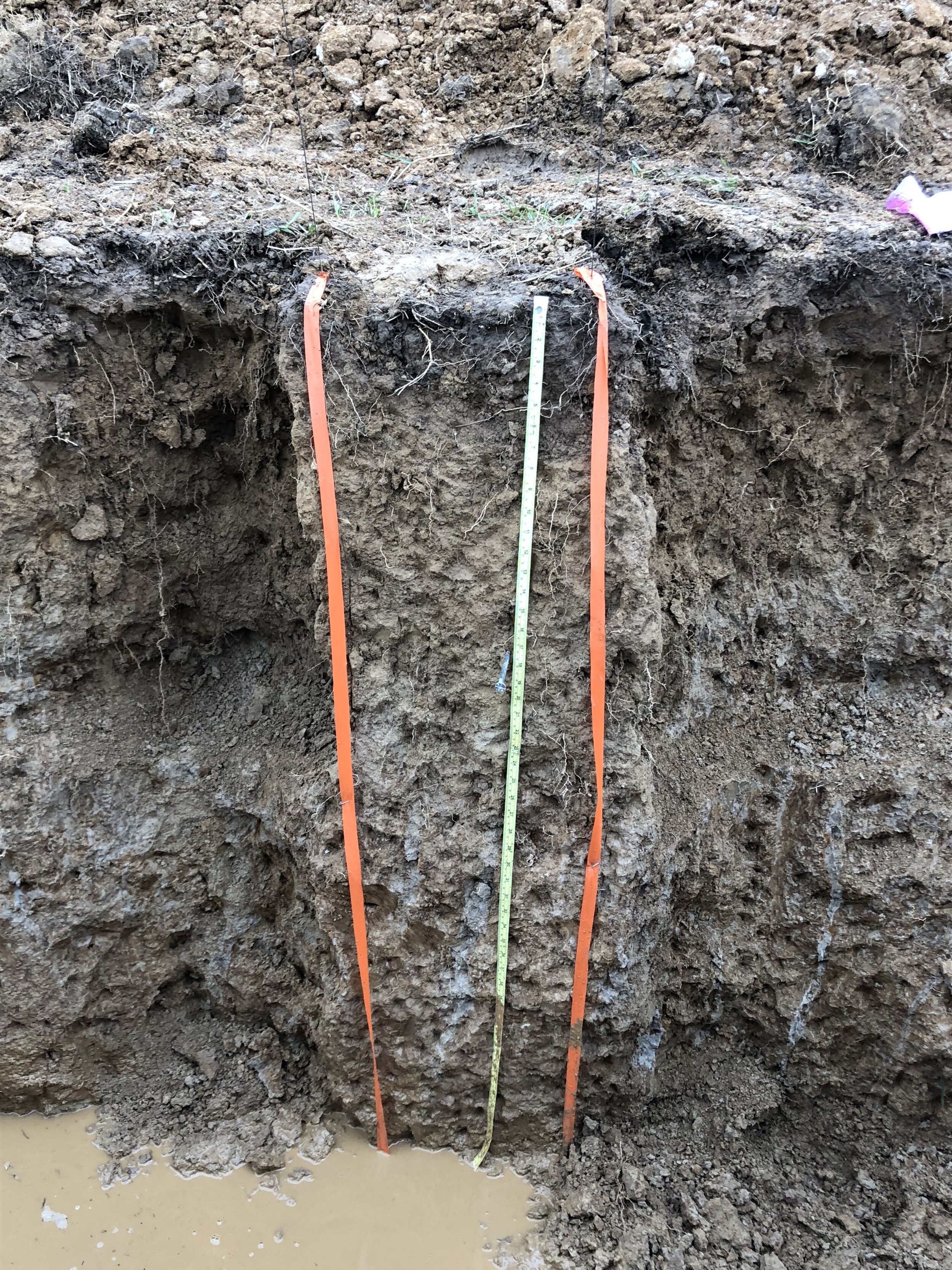
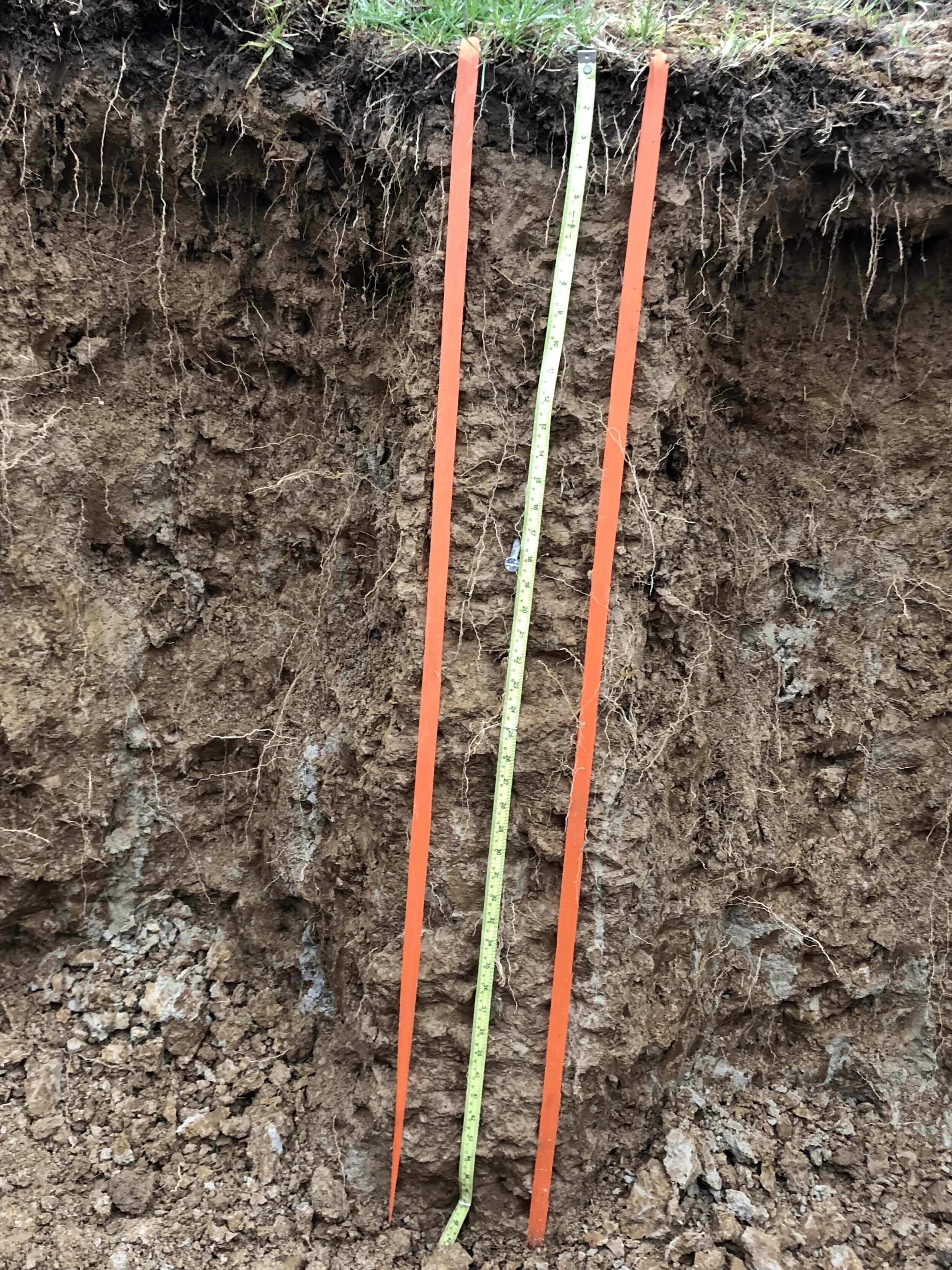
It is 9AM on a cold Tuesday morning in west Tennessee, and I find myself in a two-meter-deep pit in the middle of a farm field. The water in the ponded pit reaches up past the knee of my waders, and I can feel that my feet are stuck in the mud underneath. I can’t feel my fingers, but still I persevere, focusing on the task at-hand of acquiring samples from each horizon of the soil profile in front of me before I must get back out. This is just the start of a regular practice day during the week of the National Collegiate Soils Contest.
Five minutes in the pit, five minutes out. Ten minutes in, ten minutes out. Five minutes in, five minutes out. All followed by a twenty-minute free-for-all. Much like any other contest, soil judging has clearly defined rules. At the start of the contest, competitors are given scorecards and taken to soil pits. Each individual competitor has an hour at each pit to fill out their scorecard describing the morphology of the soil in the pit: its horizonation, structure, color, texture, redox concentrations, and taxonomy, just to name a few of the described features. After each competitor has judged every pit, the scorecards are graded for accuracy based on data collected by the hosting university. The individuals are ranked based on the highest combined scores.
The soils of Tennessee offered us great challenge and created much confusion with the presence of many unfamiliar features, such as the elusive glossic horizon, the cryptic lamellae, and the enigmatic plinthite; however, none of these features baffled us quite like the mysterious fragipan. Fragipans make up the dense, brittle subsurface layers hypothesized to form under conditions of compaction, deformation, and contraction (Graveel, Tyler, Jones, & McFee, 2002). As root- and water-limiting layers, calling a horizon a fragipan makes all the difference in correctly determining such important features as effective soil depth, depth to seasonally high water table, and water retention as well as soil taxonomy. Essentially, scoring well in the contest depended on correctly identifying fragipans. This may be appropriate, for the presence of and depth to a fragipan has major land use implications. Fragipans are shown to limit crop growth, with a study of soybean crops demonstrating decreases in both root growth and crop yields as depth to a fragipan decreases (Graveel, Tyler, Jones, & McFee, 2002). This issue becomes even more pressing in areas of loess deposition. The wind-blown silt blanketing the surface in such regions is highly vulnerable to erosion, especially in agricultural fields without proper erosion protection protocols, so these fields are at risk of losing yields over time due to this effective decrease in depth to fragipans.
The contest concluded with an awards ceremony under the iconic Eiffel Tower of Paris, TN. We took home fourth place overall, coming home with a lovely plaque and a much greater understanding of the soils of Tennessee.
References
Graveel, J. G., Tyler, D. D., Jones, J. R., & McFee, W. W. (2002). Crop yield and rooting as affected by fragipan depth in loess soils in the southeast USA. Soil and Tillage Research.
Smalley, I. J., Bentley, S. P., & Markovic, S. B. (2016). Loess and fragipans: Development of polygonal-crack-network structures in fragipan horizons in loess ground. Quaternary International.